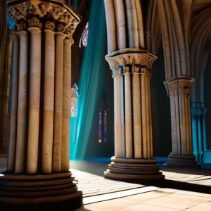
I remember standing in a damp, salt-crusted courtyard in Syracuse last autumn, squinting at a limestone frieze that was literally crumbling under the weight of its own history. A young technician was hovering nearby, waving a high-end laser scanner around like it was a magic wand, convinced that a million-euro piece of hardware was the only way to “save” the site. It frustrated me; there is this modern obsession with thinking that expensive gear replaces the need for actual observation. We talk about photogrammetry and surveying as if they are these sterile, digital panaceas, but if you aren’t looking for the way the light hits a specific chisel mark or how a joint has shifted over three centuries, you’re just collecting useless clouds of points.
I’m not interested in the glossy sales pitches or the theoretical perfection of a digital twin. In this series, I want to talk about how we use these tools to actually listen to the stone. I promise to share the messy, practical reality of combining high-tech data with the old-fashioned intuition of a conservator. We will look at how to turn raw measurements into a narrative of human intent, ensuring that the technology serves the history, rather than obscuring it.
Table of Contents
Capturing the Soul Through Geospatial Data Acquisition
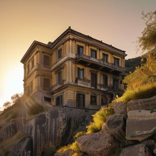
When I stand before a crumbling facade in the hills of Sicily, I am not just looking at a wall; I am looking at a complex, three-dimensional puzzle of gravity and intention. Traditional methods often fail to capture the nuance of how a structure actually sits within its environment. This is why I have come to rely so heavily on geospatial data acquisition. It isn’t just about getting a digital copy; it is about capturing the way a foundation has settled into the earth over five centuries. By utilizing modern UAV surveying techniques, we can finally bridge the gap between a flat blueprint and the messy, beautiful reality of a building’s physical presence.
The real magic happens when we move beyond simple photography and into the realm of high-density data. I often find myself debating the merits of LiDAR vs photogrammetry depending on the specific task at hand. While photogrammetry gives me that vital, skin-deep texture of the stone and the exact hue of the lime mortar, LiDAR can pierce through the overgrowth of an abandoned ruin to reveal the underlying geometry. Both methods feed into the same goal: transforming raw light and laser pulses into a meticulous point cloud processing workflow. This allows us to see the structural truth of a site, long before a single stone is touched by a restorer’s hand.
When Light Becomes a Permanent Record

There is a specific kind of magic that happens when you stop looking at a façade as a single image and start seeing it as a collection of millions of coordinates. When I set up my rig, I am not just taking pictures; I am waiting for the light to cooperate so that every micro-fissure in the travertine is caught. This is where the real distinction lies in the debate of LiDAR vs photogrammetry. While a laser scan might slice through the darkness to give me a structural skeleton, photogrammetry allows me to retain the chromatic truth of the stone. It captures the way the salt air has bleached the marble or how the lichen has crept into a Roman joint, turning a mere measurement into a sensory record.
Once the images are captured, the heavy lifting begins in the digital darkroom. Through rigorous point cloud processing, those thousands of snapshots coalesce into a digital twin that is more honest than any hand-drawn sketch could ever be. You begin to see the subtle undulations in a wall that suggest a settling foundation or a mason’s slight error in leveling. It is no longer just a survey; it is a way of freezing time, ensuring that even if the stone eventually turns to dust, the logic of its construction remains etched in light.
The Digital Trace and the Human Hand
We have moved far beyond the simple era of the tape measure and the hand-drawn sketch, though I still find myself reaching for my charcoal pencil when the light hits a courtyard just right. Through photogrammetry, we are no longer just capturing a facade; we are digitizing the very logic of construction. By weaving together geospatial precision with high-resolution imagery, we create a record that captures the subtle irregularities of a lime mortar joint or the slight subsidence of a Roman foundation. This isn’t about replacing the architect’s eye, but rather about giving that eye a way to freeze time, ensuring that the minute technical decisions of a master mason from five centuries ago are preserved with mathematical certainty.
Ultimately, these digital models are more than just clouds of points or textured meshes sitting on a hard drive. They are our most sophisticated way of listening to the stones. When we use these tools to map the scars, the repairs, and the structural shifts, we are performing a kind of technological archaeology. We are ensuring that when the next generation of conservationists stands before these walls, they won’t just see a beautiful ruin; they will see the exact, intricate sequence of how it was brought into being. We don’t survey to document what is there, but to honor the intention of those who built it.